Climate Risk Assessment for mountainous communities of Tajikistan and Kyrgyzstan.
Elaboration of future climate scenarios and the analysis of climate risk based on the Impact Chain methodology in the target areas of Tajikistan and Kyrgyzstan to support UNEP’s “Vanishing Treasures” Programme aiming to generate maximum synergy between climate change adaptation and biodiversity conservation.
Country Tajikistan; Kyrgyzstan Duration 1.12.2020 – 29.04.2022 | 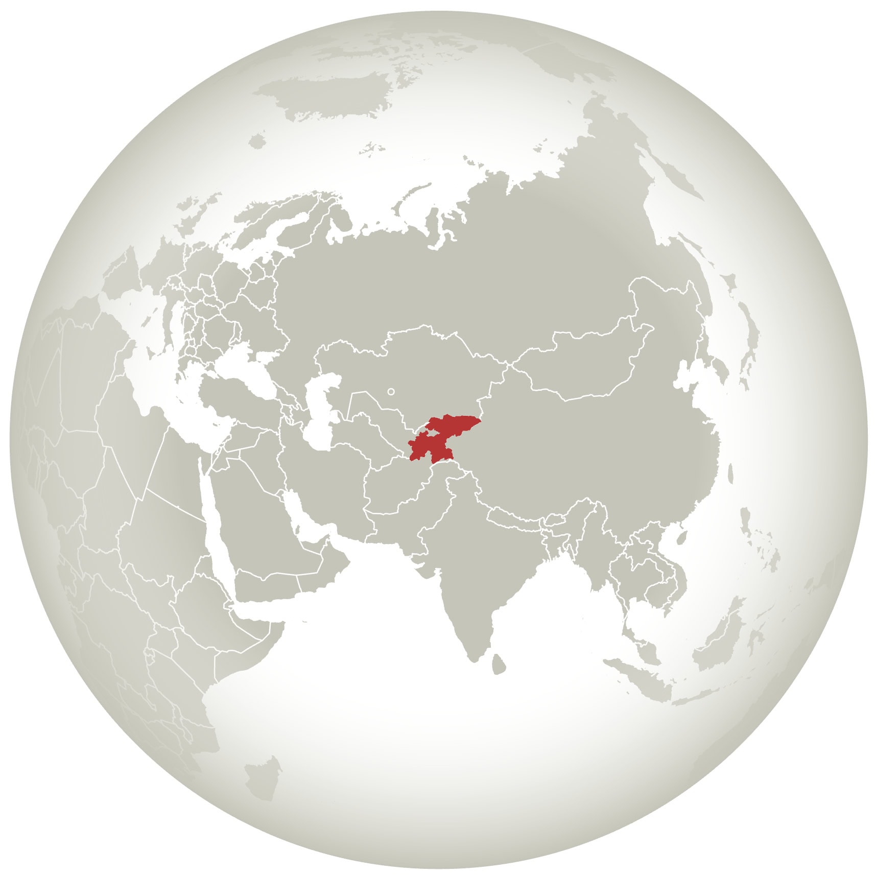 |
Mountain species that are already endangered are additionally threatened by Climate Change. UNEP’s ‘Vanishing Treasures’ Programme supports climate change adaptation of vulnerable species in mountain regions such as in Hindu-Kush Himalayas (Bhutan), in Central Asia (Kyrgyzstan and Tajikistan) and in Virunga region (Rwanda and Uganda). In order to generate synergy between climate change adaptation and biodiversity conservation it is necessary to understand current and future potential risks of climate change to local communities living in close proximity to these species and their habitats. By understanding key climate risks and potential human-wildlife conflicts climate-smart measure can be integrated into conservation planning.
Future climate scenarios and climate risk assessments were elaborated in selected project regions and communities of Tajikistan and Kyrgyzstan to provide the Programme with the needed information to plan specific measures.
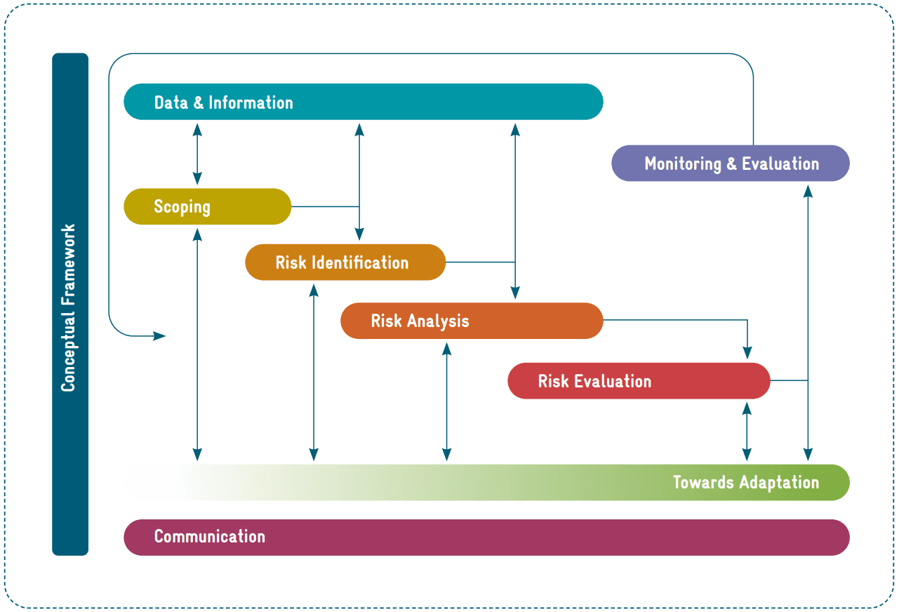
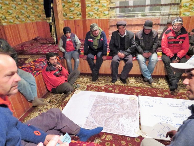
The assessment built upon the Impact Chain analytical approach of the Vulnerability Sourcebook Risk Supplement. To apply this analytical approach and assess each of the risk components and the overall risk, quantitative data analyses (climate scenarios, climate indices and extremes, snow cover, glacier extent) were combined with qualitative information collected through participatory methods (workshops with experts, community consultations) and secondary sources. While the climate analysis refers to national and project region levels, the assessment of climate risks focuses on the specific communities, where community consultations and field visits took place, and for which a better understanding of climate impacts and vulnerability factors could be obtained.
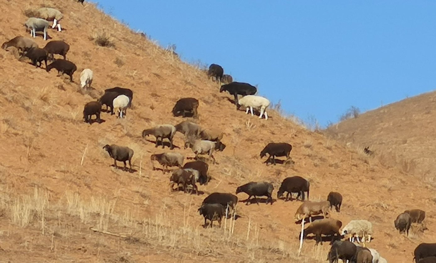
For the visited communities in Tajikistan, the main climate risk identified and assessed refers to the risk of loss of livelihoods for livestock owners due to drought impact on pasture, and missing irrigation water for fodder and food production. For the visited communities in Kyrgyzstan, the main climate risk identified and assessed refers to the risk of loss of livelihoods for livestock owners due to drought impact on pasture, missing irrigation water for fodder and food production, and heat-exacerbated animal disease. The absence of water governance destroyed water irrigation channels and lack of investments in infrastructure development have been identified as major vulnerability factors and are currently the drivers of a mainly human-induced water stress in the visited communities of the two countries.
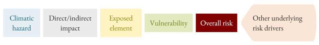
Impact chains were developed together with stakeholders for three key risks. See for example the impact chain “Risk of loss of livelihoods (income, subsistence) for livestock owners due to drought impact on pasture, missing irrigation water for fodder and food production and heat exacerbated animal disease” below.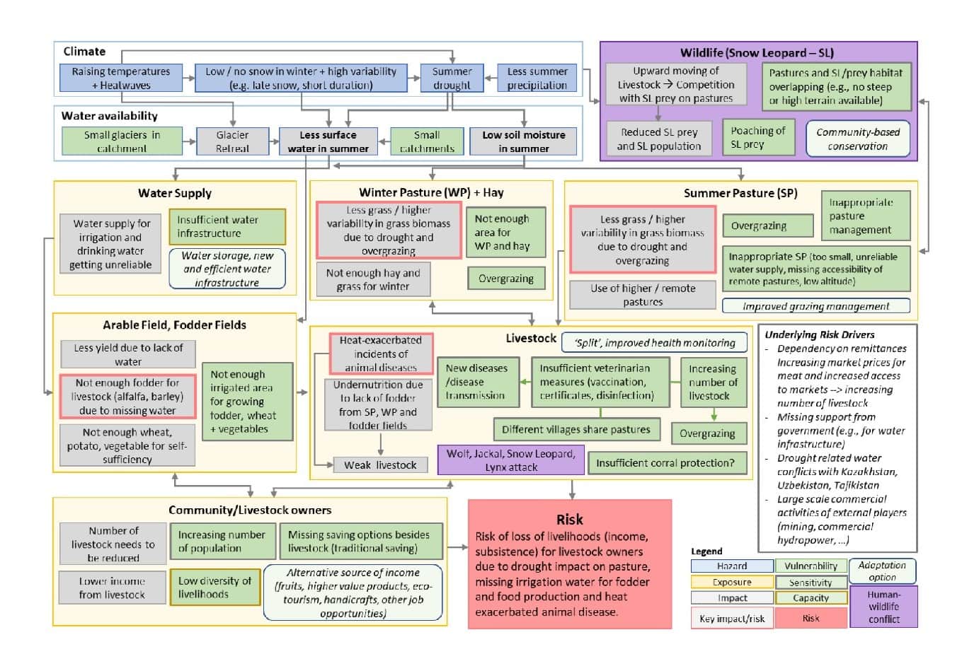
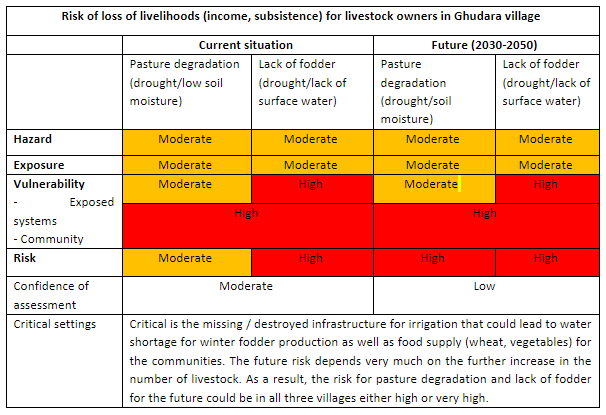
Comprehensive risk assessment tables were developed for every key risk and for each project site (community level). Below is an example of such a table for the Risk of loss of livelihoods (income, subsistence) for livestock owners in Ghudara village, Tajikistan.
Climate Risk Assessment in the Sebou Catchment, Morocco – a first pilot study of the new Climate Risk Sourcebook.
Test and application of the approaches of the new Climate Risk Sourcebook in the framework of Moroccan-German project “Rural Resilience – Water Resources Management for Poverty Reduction and Resilience Building” (RR) (Project-Nr., 2018.2115.6). The focus was on building impact chains for key risks and supporting the selection of adaptation options.
Country Morocco Duration 24.01.2023 – 24.07.2023 |
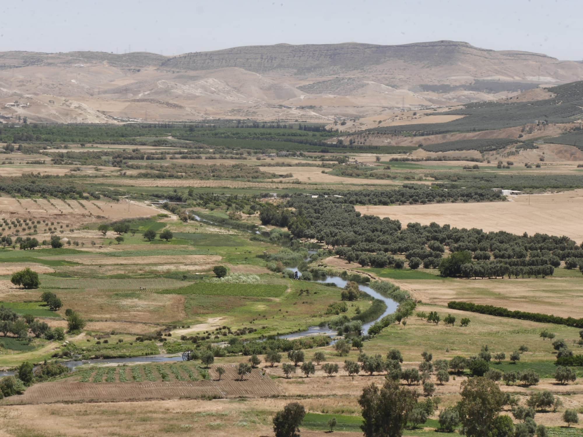
This study was carried out within the scope of the GIZ project Résilience Rural (RR), which has the overall objective to strengthen the resilience of smallholder farmers in Morocco. The study looks particularly into the climate risks related to water scarcity and prepared the ground for feasible options to adapt to related pressures of the current and possible also future challenges. The geographical extent of this study is set by the Sebou River catchment in the northern part of Morocco. It strongly builds on the findings of the three intervention areas of the RR project in this region, namely Aït Hsaine Ouhaned, Aït Saïd Ouhaddou and Ouled Slimane. The study’s objective is both to support the RR project in their climate risk analysis as well as in the identification of feasible adaptation options and to present a pilot study for the online version of the new Climate Risk Sourcebook (CR-SB).
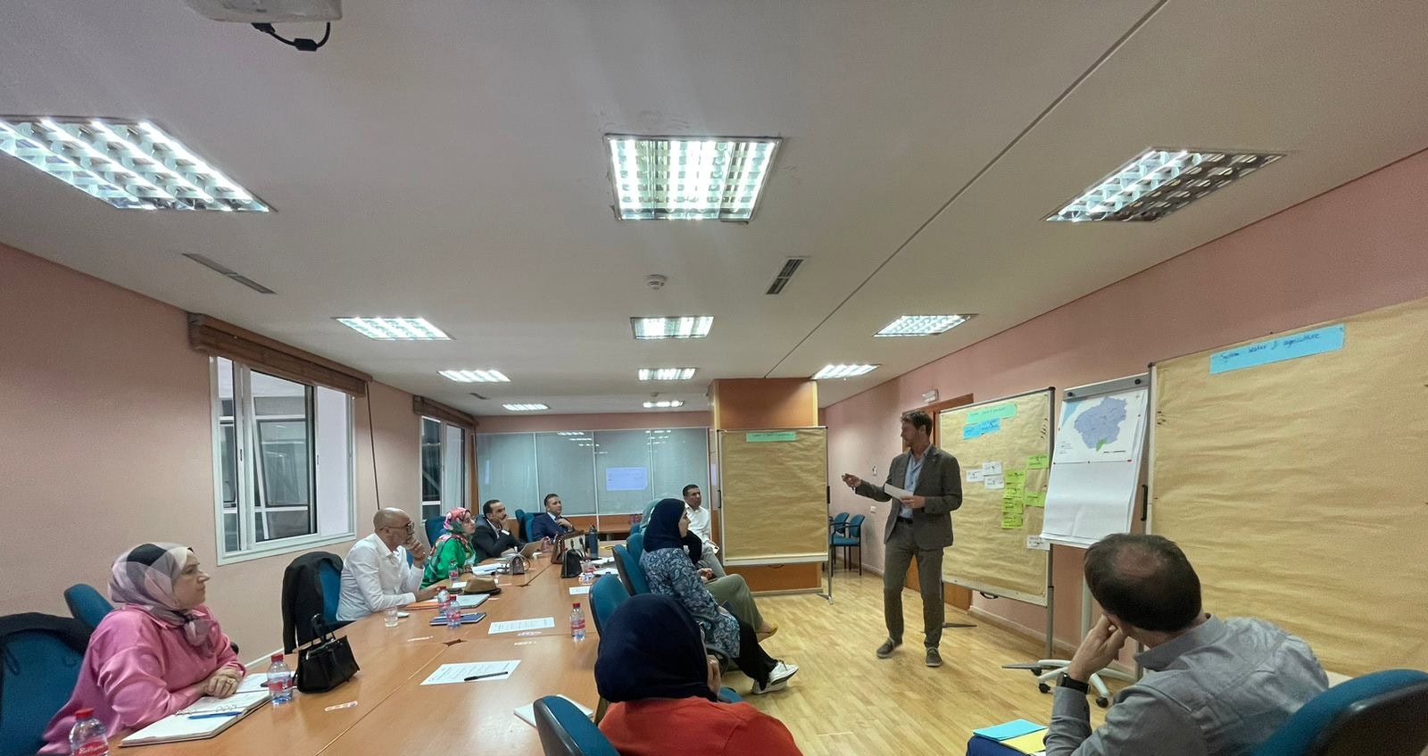
Results were based on findings from the RR project including the collection of available information on climatic and non-climatic risk drivers within the region. Initial impact chains, that have been developed within local workshops were refined and reviewed by GIZ with the help of experts from Eurac Research. Further input on climate risks in the Sebou catchment have been collected during a field stay, a 5-day consultation with local GIZ experts and a full day workshop in Rabat with participants from different departments and NGOs.
The assessment was following the new Sourcebook with its new modules. The focus was on scoping, risk identification and risk analysis with impact chains for the current and near-term period. Furthermore, the module “Towards adaptation” was tested.
Key risks to three subsystems where assessed:
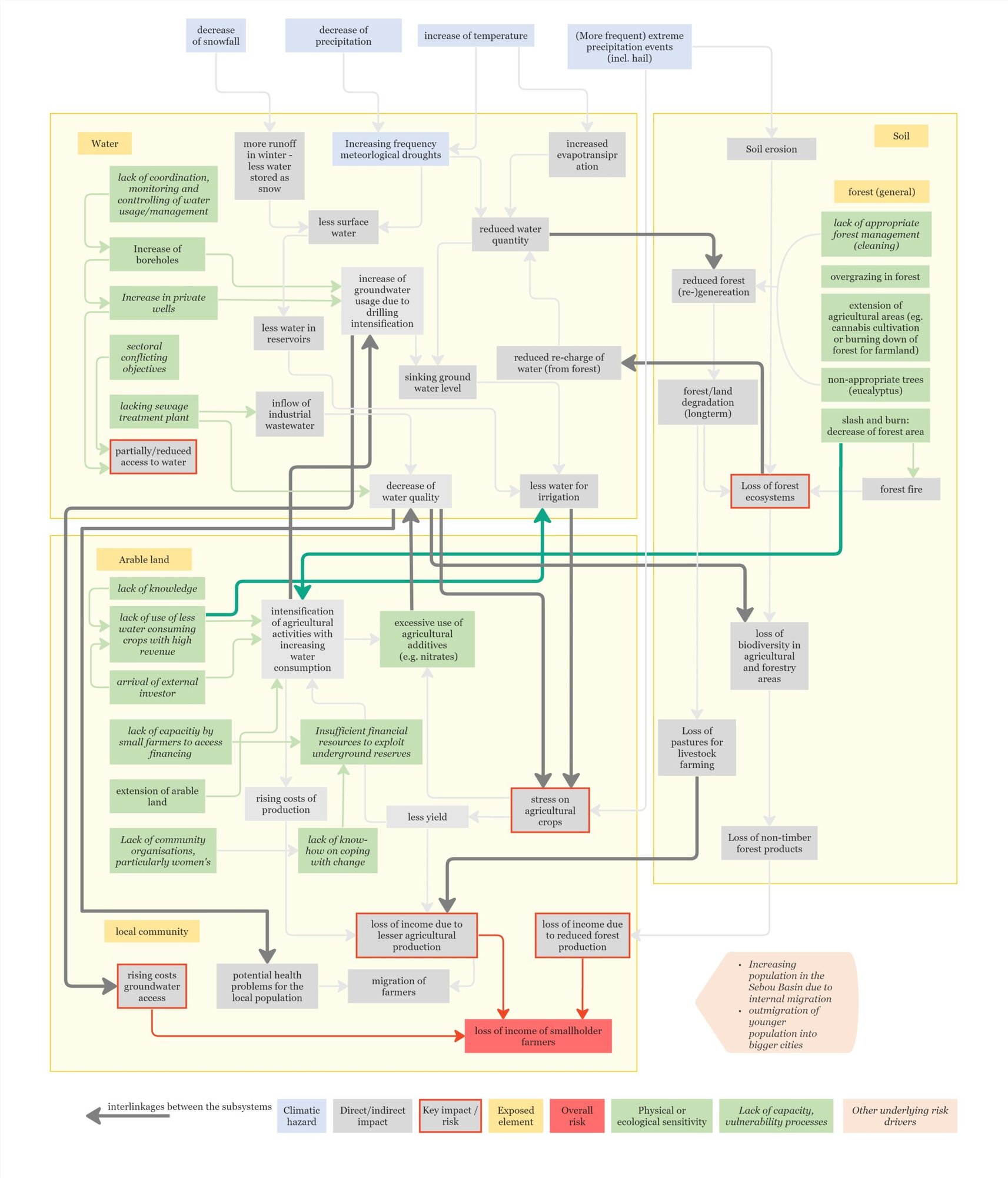
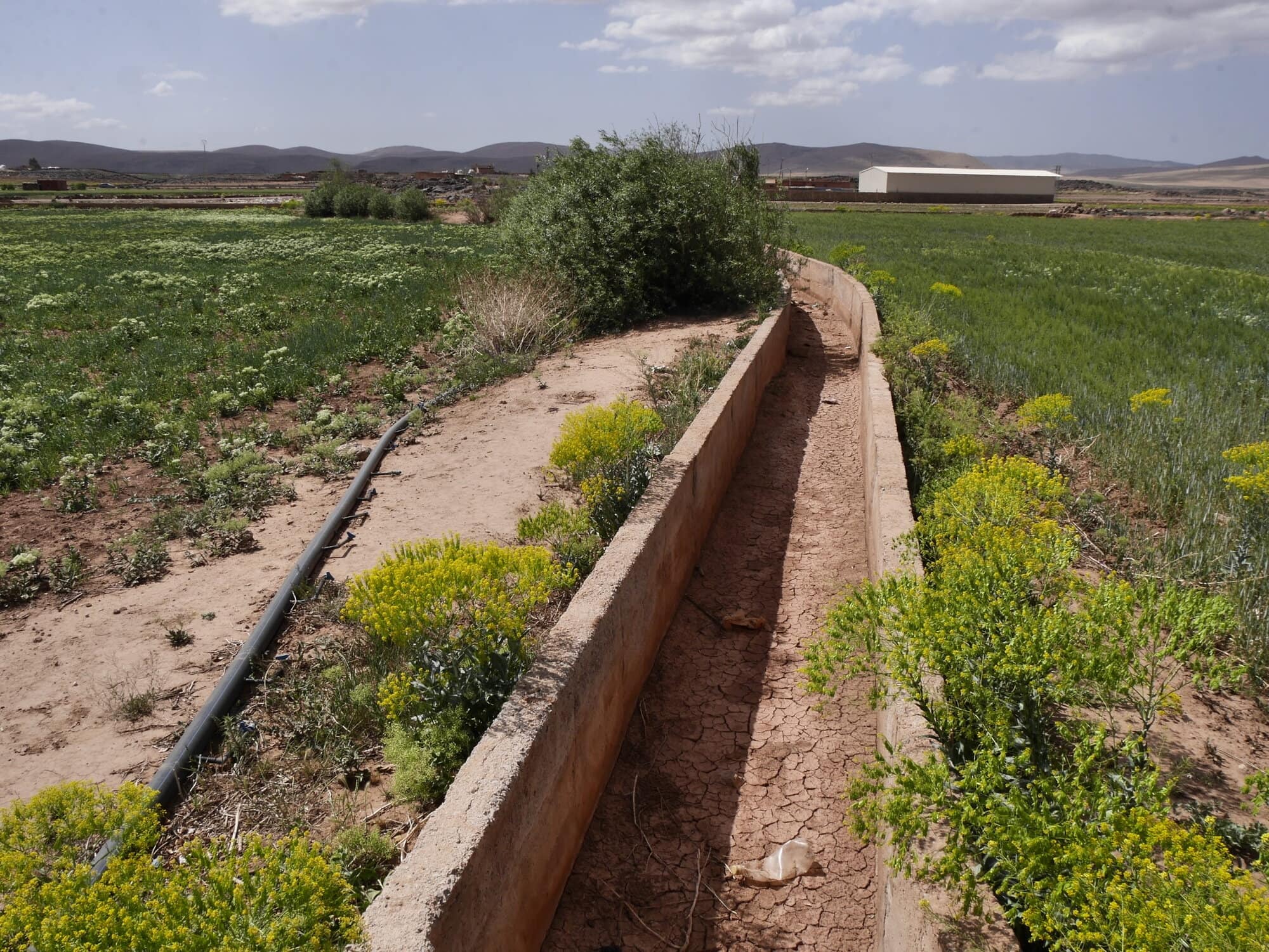
The main climate-induced water-related risk concerning smallholder farmers is a reduced quantity of water available for agricultural activities. The risk of reduced water availability in the Sebou catchment is based on the two major aspects of water supply and water demand. The water supply is mainly influenced by rising evapotranspiration losses with the consequence of reduced surface water and slowing groundwater replenishing processes. The water demand in agriculture in the catchment is strongly linked to the extension of irrigated agricultural areas. The reduced water supply combined with the increase in water demand leads to growing water stress in the region evident by drying springs and vanishing surface water in most time of the year. A severe consequence of this situation is an intensification of groundwater withdrawal for agricultural activities resulting in lowered groundwater tables, reported to be sinking by up to several meters a year.
With less water available for irrigation in agriculture, crops get exposed to more stress, which leads to less yield and a reduced quality of it. Another factor that exerts stress on yield are extreme precipitation events like hailstorm that damage the crop or can even immediately cause yield losses. On the one hand reduced yield causes for small holder farmers a key impact of a loss of income as they can sell less crops on the market. In the absence of resilience mechanisms, the population is beginning to abandon the traditional way of life and many young people are leaving the area.
Besides droughts, non-climatic drivers such as the extension of agriculture land through deforestation or grazing in forests are putting pressure on forest ecosystems. A degrading forest facilitates soil erosion, which is also likely to occur more often due to the increase of extreme rain events. This leads to the loss of biodiversity in the forest and associated with this also the loss of non-timber forest products.
Impact chains were developed and refined based on input form the project, consultation with GIZ experts, a field stay and workshop. Impact chains were developed for each subsystem (water, agriculture, forest and grassland ecosystems) separately. Finally, one overall impact chain with a focus on the interlinkages between the systems was developed (see Figure 1)
Applying the new module “Towards adaptation” and taking the identified key risks and the risk mechanisms (impact chains) into account, a series of adaptation options was identified:
For the system water & agriculture:
| Vulnerability factor | Measure | Description | Impact addressed |
| Lack of coordination, monitoring and controlling of water usage/management | Establishment of a ‘water police’
| Intended to monitor withdrawals from water sources to prevent excessive, illegal pumping. This reduces the illegal emptying of groundwater reservoirs
| Increase of groundwater usage due to drilling intensification |
Sectoral conflicting objectives, lack of coordination, monitoring and controlling of water usage/management | Establishment of associations of Agricultural Water Users
| Better coordination of farmers’ water needs, strengthen voice and resilience of individual farmers | Reduced access to water |
Lack of coordination, monitoring and controlling of water usage/management, lacking sewage treatment plant | Re-use of wastewater | Reduces dependence on rain/groundwater – can ensure irrigation during dry periods
| Less water for irrigation |
| Sectoral conflicting objectives | Capacity building | Intended to increase the ability to coordinate different objectives of water usage | Partially/reduced access to water & rising costs in groundwater access |
| Increase in private wells | Awareness raising: groundwater as common resource | Respecting the general good. Reduction of individual well development | Increase of groundwater usage due to drilling intensification |
For the system ecosystem & biodiversity:
Vulnerability factor | Measure | Description | Impact addressed |
Non-appropriate trees (e.g. eucalyptus) | Using appropriate tree species (capacity building contributes to this) | Less water intensive species -> less water consumption | Reduced forest (re)generation |
Overgrazing in forest | Job creation/reduction of poverty | Alternative incomes outside agriculture -> farmers no longer have to overuse/overgraze pastures to have sufficient income -> Forest able to regenerate
| Reduced forest (re)generation |
Extension of agricultural areas (e.g. cannabis cultivation or burning down of forest for farmland) | Forest protection | Establishing protected areas with limited human presence or exploitation of natural resources | Reduced forest (re)generation |
Lack of awareness of value of forest | Awareness raising for the forest ecosystem services | Capacity building highlights the importance of forest ecosystem services -> appreciation and consideration for natural processes increase | Reduced forest (re)generation & loss of forest ecosystems |
Programme de Renforcement des conditions et Capacités d’adaptation durable au Changement Climatique/ Programme d’appui au gestion d`environnement (PRCCC/PAGE)
Programme to Strengthen Conditions and Capacities for Sustainable Adaptation to Climate Change/ Environmental Management Support Programm .
The overall objective was to identify climate related risks and to development context-specific adaptation solutions.
Country Madagascar Regions Analamanga, Boeny and Diana Duration 01.2022-05.2022 (excluding May) | 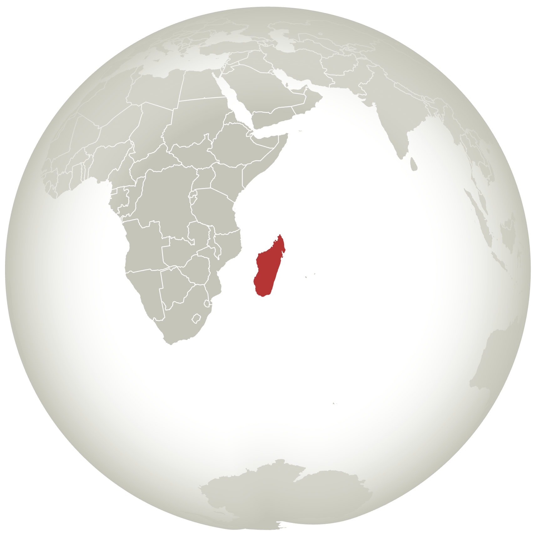 |
The intensifying impacts of climate change in Madagascar threaten the livelihoods of local communities and the well-being of natural ecosystems. Since the negative impacts of climate change are already present in Madagascar and will further intensify over the upcoming decades it is a priority for Madagascar´s government to take the necessary adaptation measures for local adaptation planning. Within each region, Boeny, Diana and Anamalanga, a comprehensive risk assessment was conducted across various sectors including agriculture and livestock, water supply and sanitation, forest and biodiversity. In Analamanga, a specific assessment of infrastructure including the city of Antananarivo was undertaken, whereas in Boeny and Diana, the project extended its scope to encompass coastal areas and fisheries.
The risk assessment was conducted by Madagascar´s National Environmental Agency (ONE), based on the results of the previous assessment implemented by adelphi consultant GmbH. The procedure and methodology was oriented according to the Climate Vulnerability Sourcebook. The approach of using impact chains as explained in the Climate Vulnerability Sourcebook had the advantage of illustrating the complex inter-relations between hazards, exposure, vulnerabilities, and risks. To provide tailor-made solutions for the target region an adapted version to the Malagasy context was developed and used. Adaptation measures for each region and for the municipal level were identified. The method combined quantitative and qualitive data such as climate scenarios, climate indices and extremes on the one hand and workshops with experts, community consultations and field visits on the other hand.
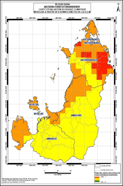
Here we exemplary present the results of the forest and biodiversity sector in the Diana region.
The increase in duration of strong winds caused by trade winds (varatraza) and cyclones is the main climatic threat to the Diana region. Combined with changes in precipitation and increasing temperatures, these hazards have an adverse impact on biodiversity of the region. The main risks posed by these climatic hazards are:

You are currently viewing a placeholder content from Vimeo. To access the actual content, click the button below. Please note that doing so will share data with third-party providers.
More InformationYou are currently viewing a placeholder content from YouTube. To access the actual content, click the button below. Please note that doing so will share data with third-party providers.
More InformationYou need to load content from reCAPTCHA to submit the form. Please note that doing so will share data with third-party providers.
More InformationYou need to load content from reCAPTCHA to submit the form. Please note that doing so will share data with third-party providers.
More InformationYou are currently viewing a placeholder content from Google Maps. To access the actual content, click the button below. Please note that doing so will share data with third-party providers.
More InformationYou are currently viewing a placeholder content from Google Maps. To access the actual content, click the button below. Please note that doing so will share data with third-party providers.
More InformationYou are currently viewing a placeholder content from Mapbox. To access the actual content, click the button below. Please note that doing so will share data with third-party providers.
More InformationYou are currently viewing a placeholder content from OpenStreetMap. To access the actual content, click the button below. Please note that doing so will share data with third-party providers.
More Information